Barre des Ecrins - Photoreal plus mesh FSX & P3D
{niceaccess:12}
Very beautiful scenery, half of which has been made by Rikoooo, in this case the mesh LOD11 (elevation) Southeast of the Alps.
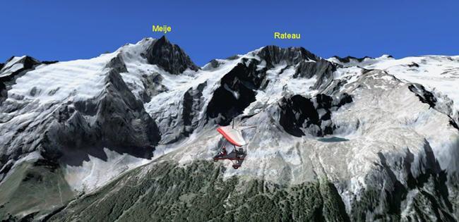
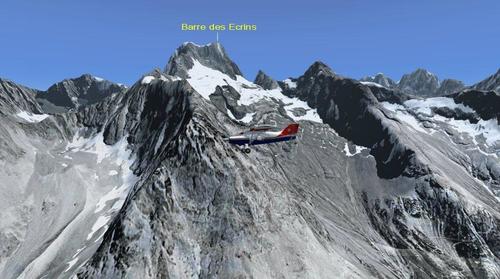
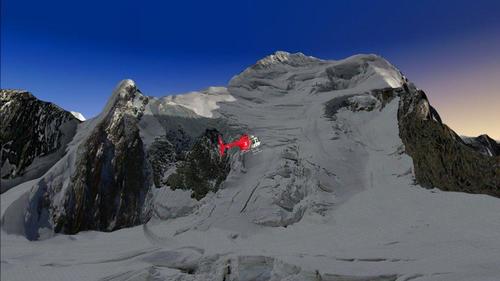
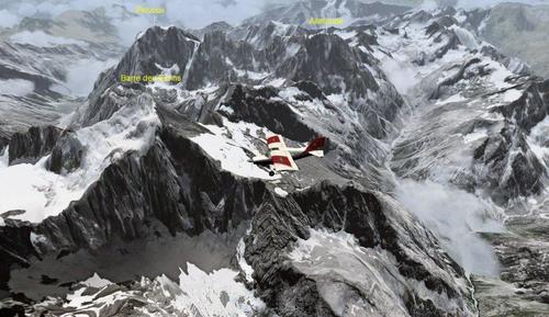
The scenery consists of the HD Barre des Ecrins and its surroundings.
The Barre des Ecrins is the highest peak in the Provence-Alpes-Cote d'Azur, located away from the dividing line between the waters of the Durance and Vénéon. This line runs west of the summit on the summit ridge to the peak Lory (4088 meters). The south side is rocky, while the north face ice is (starting point of the Glacier White).
She is on the Common in Pelvoux Vallouise.
It is also the highest peak in Occitan and Southern Alps

Superb ride in the heart of the mountains, pure air !
Additional information can be found in your "Start menu -> Add-ons Rikoooo -> Barre des Ecrins - Photoreal plus mesh FSX & P3D"
The installation is 100% automated by Rikoooo, the configurator will handle for you the registration and activation of the scenery in Flight Simulator. When uninstalling, the installer will restore your configuration of origin.
Caution large file 298 MB, it is recommended to use a download accelerator software to pause and resume at the point of arrest to have no surprises (eg FlashGet).
Important, how to use the scenery ? Start a flight, then during the game open the map and enter one of the GPS adress below to move directly your aircraft to the most interesting points:
Barre des Écrins - Photoreal
Transcribe exactly the coordinates as shown below :
N44°55 23
E6°21 36

You can also take your flight from one of the two Grenoble airports or from Saint Crepin (LFNC) and then direct fly to the Barre des Ecrins.
Here is the area supported by the mesh LOD11 Rikoooo:
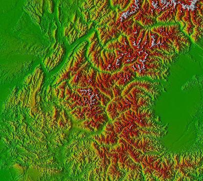
Very beautiful scenery, half of which has been made by Rikoooo, in this case the mesh LOD11 (elevation) Southeast of the Alps.
The scenery consists of the HD Barre des Ecrins and its surroundings.
The Barre des Ecrins is the highest peak in the Provence-Alpes-Cote d'Azur, located away from the dividing line between the waters of the Durance and Vénéon. This line runs west of the summit on the summit ridge to the peak Lory (4088 meters). The south side is rocky, while the north face ice is (starting point of the Glacier White).
She is on the Common in Pelvoux Vallouise.
It is also the highest peak in Occitan and Southern Alps

Superb ride in the heart of the mountains, pure air !

Additional information can be found in your "Start menu -> Add-ons Rikoooo -> Barre des Ecrins - Photoreal plus mesh FSX & P3D"
The installation is 100% automated by Rikoooo, the configurator will handle for you the registration and activation of the scenery in Flight Simulator. When uninstalling, the installer will restore your configuration of origin.
Caution large file 298 MB, it is recommended to use a download accelerator software to pause and resume at the point of arrest to have no surprises (eg FlashGet).
Important, how to use the scenery ? Start a flight, then during the game open the map and enter one of the GPS adress below to move directly your aircraft to the most interesting points:
Barre des Écrins - Photoreal
Transcribe exactly the coordinates as shown below :
N44°55 23
E6°21 36

You can also take your flight from one of the two Grenoble airports or from Saint Crepin (LFNC) and then direct fly to the Barre des Ecrins.
Here is the area supported by the mesh LOD11 Rikoooo:

 LOADING ...


